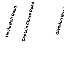
99-U 14 UNCLE ROLF ROAD DP
Owner Information
SILVIA KIM M TRUSTEE
10 GREENBRIAR ROAD
BROCKTON, MA 02301


Property Details
99-U 14 UNCLE ROLF ROAD DP is classified as a Residential Condominium (Sngl fam ssnl).
The primary structure on this property was built in 1948. There are 840ft2 of built area within this property. There is 840ft2 of residential/living space within this property. This property is listed as having 5 rooms.
99-U 14 UNCLE ROLF ROAD DP is valued at $385,700. The land is valued at $0 and the structures are valued at $385,700.
99-U 14 UNCLE ROLF ROAD DP was last sold on Monday, June 25, 2018 for $0.
Assessment data from fiscal year 2022.
Flood Data
According to the FEMA National Flood Hazard Layer, this property does not appear to be in a flood zone. It may also be in an area not yet reviewed. Nonetheless, confirm this information prior to taking any action.
To view the flood hazards around this property, create a FEMA "Firmette" Map of the area around 99-U 14 UNCLE ROLF ROAD DP.
Broadband Internet Providers
| Provider | Type | Bandwidth (mbps) | |
|---|---|---|---|
| Viasat Inc | Satellite | 35 | 3 |
| HughesNet | Satellite | 25 | 3 |
| VSAT Systems, LLC. | Satellite | 2 | 1 |
| Verizon New England Inc. | DSL | 5 | 0 |
| Comcast | Cable | 1000 | 35 |
| GCI Communication Corp. | Satellite | 0 | 0 |
Broadband service provider data from December 2020.
Adjacent Properties
- 97 UNCLE ROLF ROAD DP
Single Family Residential owned by SANNICANDRO ALFRED P TRUSTEE - 120-UN 6 OLD WHARF ROAD DP
Residential Condominium owned by MACOMBER RUSSELL S ET UX - 120-UN 1 OLD WHARF ROAD DP
Residential Condominium owned by FRANCO LEE V ET UX - 120-UN 2 OLD WHARF ROAD DP
Residential Condominium owned by BERKLEY GARY ET ALI - 120-UN 3 OLD WHARF ROAD DP
Residential Condominium owned by COPELAND GERARD J - 120-UN 4 OLD WHARF ROAD DP
Residential Condominium owned by CABLE RICHARD E ET ALI - 120-UN 5 OLD WHARF ROAD DP
Residential Condominium owned by LITTS EVANTHIA R - 120-UN 7 OLD WHARF ROAD DP
Residential Condominium owned by WILSON ROBERT D ET UX - 120-UN 8 OLD WHARF ROAD DP
Residential Condominium owned by WOODS THOMAS E ET UX - 120-UN 9 OLD WHARF ROAD DP
Residential Condominium owned by MALLICK RAJANI K TRUSTEE - 120-UN 10 OLD WHARF ROAD DP
Residential Condominium owned by COCHRANE DOUGLAS ANDREW JR - 120-UN 11 OLD WHARF ROAD DP
Residential Condominium owned by MCGINNITY THOMAS IT UX - 120-UN 12 OLD WHARF ROAD DP
Residential Condominium owned by PAGANINI JOSEPH J ET AL - 120 OLD WHARF ROAD DP
Other, Non-Taxable Condominium Common Land owned by OCEAN WINDS CONDO - 112-UE-14 OLD WHARF ROAD DP
Residential Condominium owned by DUNLEAVY KEVIN M ET UX - 112-U-W16 OLD WHARF ROAD DP
Residential Condominium owned by KRUPSKI MICHAEL W - 112-U E-4 OLD WHARF ROAD DP
Residential Condominium owned by TOSTI MARIO - 112-U E-1 OLD WHARF ROAD DP
Residential Condominium owned by LEFEVRE MAE T - 112-UE-2 OLD WHARF ROAD DP
Residential Condominium owned by ROBBINS MEGAN - 112-U E-9 OLD WHARF ROAD DP
Residential Condominium owned by JOHANSON MITCHELL - 112-UE-10 OLD WHARF ROAD DP
Residential Condominium owned by HEALY WILLIAM F III - 112-U-C1 OLD WHARF ROAD DP
Residential Condominium owned by BINCZYK WALDEMAR D ET UX - 112-U-C2 OLD WHARF ROAD DP
Residential Condominium owned by BINCZYK ALEXANDER - 112-U W17 OLD WHARF ROAD DP
Residential Condominium owned by ROONEY MICHAEL ET UX - 112-UW-18 OLD WHARF ROAD DP
Residential Condominium owned by MOYNIHAN ROBERT P ET AL - 112-U W15 OLD WHARF ROAD DP
Residential Condominium owned by MACIAGA CYNTHIA - 112-UW-13 OLD WHARF ROAD DP
Residential Condominium owned by STEELE DONNA M ET AL - 112-U W14 OLD WHARF ROAD DP
Residential Condominium owned by BIANCO BARBARA - 112-U-W11 OLD WHARF ROAD DP
Residential Condominium owned by WALKER FREDERICK M JR ET UX - 112-UW-12 OLD WHARF ROAD DP
Residential Condominium owned by DANIELS RONALD P TRUSTEE - 112-U W-9 OLD WHARF ROAD DP
Residential Condominium owned by PASLASKI SUSAN M - 112-UW-10 OLD WHARF ROAD DP
Residential Condominium owned by ONEILL VERA E - 112-UW-7 OLD WHARF ROAD DP
Residential Condominium owned by COUGHLAN RICHARD B - 112-UW-8 OLD WHARF ROAD DP
Residential Condominium owned by BRENNAN PATRICIA A - 112-U W-5 OLD WHARF ROAD DP
Residential Condominium owned by HATFIELD DOUGLAS W TRUSTEE - 112-W-6 OLD WHARF ROAD DP
Residential Condominium owned by CHASE DOROTHY L C TRUSTEE - 112-U W-3 OLD WHARF ROAD DP
Residential Condominium owned by FRIGON WAYNE S - 112-U-W4 OLD WHARF ROAD DP
Residential Condominium owned by WARD JOHN R - 112-U W1 OLD WHARF ROAD DP
Residential Condominium owned by SANFORD KAREN - 112 OLD WHARF ROAD DP
Other, Non-Taxable Condominium Common Land owned by SECRET HARBOR CONDO - 112-U W-2 OLD WHARF ROAD DP
Residential Condominium owned by GALGAY JANET - 112-U-E15 OLD WHARF ROAD DP
Residential Condominium owned by RICCIARDI TIMOTHY - 112-U E16 OLD WHARF ROAD DP
Residential Condominium owned by MCNEMAR ROBERT A ET VIR - 112-U E13 OLD WHARF ROAD DP
Residential Condominium owned by KEEGAN JAMES J - 112-U-E11 OLD WHARF ROAD DP
Residential Condominium owned by SUTER SUSAN C D - 112-UE-12 OLD WHARF ROAD DP
Residential Condominium owned by ROMANO DAVID - 112-U E-7 OLD WHARF ROAD DP
Residential Condominium owned by STORLAZZI ANDREW - 112-U E-8 OLD WHARF ROAD DP
Residential Condominium owned by SMITH RICHARD J - 112-UE-5 OLD WHARF ROAD DP
Residential Condominium owned by FELDMAN MARGARITA ET UX - 112-U E-6 OLD WHARF ROAD DP
Residential Condominium owned by QUIRK RICHARD M - 112-U E-3 OLD WHARF ROAD DP
Residential Condominium owned by LAWRENCE E PRATT & ROBERT P